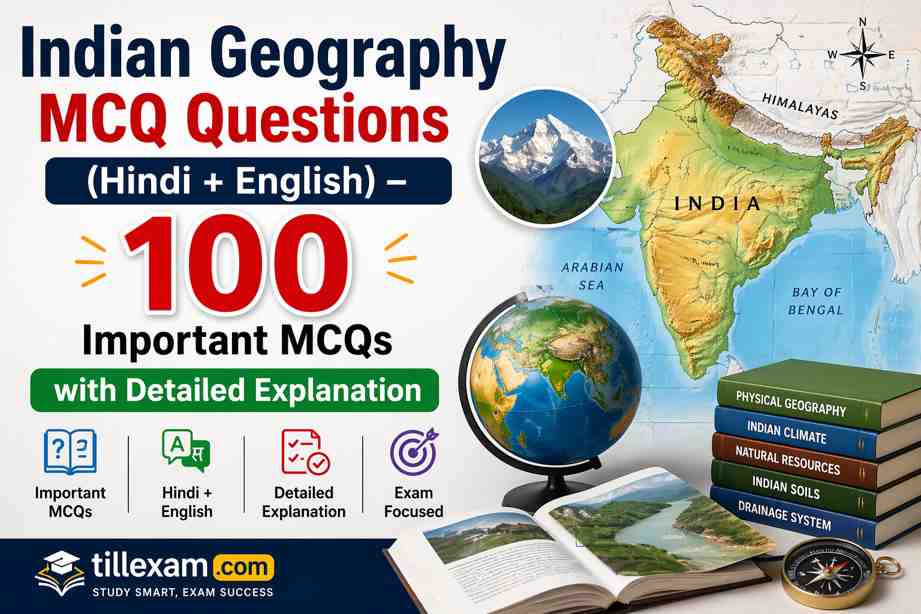
Mastering Indian Geography is a prerequisite for cracking exams like SSC GD 2026, Railway NTPC, UPSC, BPSC, and State Police. This guide covers the physical features, river systems, climate, and natural resources of India.


Indian Geography MCQs (1–100)
Q1. Which of the following latitudes passes through the middle of India?
(निम्नलिखित में से कौन सा अक्षांश भारत के मध्य से होकर गुजरता है?)
A. Equator
B. Arctic Circle
C. Tropic of Capricorn
D. Tropic of Cancer
Answer: D. Tropic of Cancer
Explanation: The Tropic of Cancer passes through 8 Indian states: Gujarat, Rajasthan, MP, Chhattisgarh, Jharkhand, West Bengal, Tripura, and Mizoram.
व्याख्या: कर्क रेखा भारत के 8 राज्यों से होकर गुजरती है: गुजरात, राजस्थान, मध्य प्रदेश, छत्तीसगढ़, झारखंड, पश्चिम बंगाल, त्रिपुरा और मिजोरम।
Q2. Which river is known as the ‘Dakshina Ganga’ (Ganga of the South)?
(किस नदी को ‘दक्षिण गंगा’ के नाम से जाना जाता है?)
A. Krishna
B. Godavari
C. Kaveri
D. Narmada
Answer: B. Godavari
Explanation: Godavari is the longest peninsular river. Due to its large size and extent, it is called Dakshina Ganga.
व्याख्या: गोदावरी सबसे लंबी प्रायद्वीपीय नदी है। इसके विशाल आकार और विस्तार के कारण इसे ‘दक्षिण गंगा’ कहा जाता है।
Q3. The ‘Majuli’ island, the largest river island in the world, is located in which river?
(विश्व का सबसे बड़ा नदी द्वीप ‘माजुली’ किस नदी में स्थित है?)
A. Ganga
B. Brahmaputra
C. Indus
D. Mahanadi
Answer: B. Brahmaputra
Explanation: Majuli is located in the Brahmaputra River in Assam. It is the first island in India to be made a district.
व्याख्या: माजुली असम में ब्रह्मपुत्र नदी में स्थित है। यह भारत का पहला ऐसा द्वीप है जिसे जिला बनाया गया है।
📢 Boost your exam preparation with our daily free mock tests on tillexam.com
Q4. Which Indian state has the longest coastline?
(भारत के किस राज्य की तटरेखा सबसे लंबी है?)
A. Andhra Pradesh
B. Maharashtra
C. Gujarat
D. Tamil Nadu
Answer: C. Gujarat
Explanation: Gujarat has the longest coastline in India, extending over 1,600 km, followed by Andhra Pradesh.
व्याख्या: गुजरात की तटरेखा भारत में सबसे लंबी है, जो 1,600 किमी से अधिक विस्तृत है, इसके बाद आंध्र प्रदेश का स्थान आता है।
Q5. The ‘Duncan Passage’ is located between which of the following?
( ‘डंकन पास’ निम्नलिखित में से किसके बीच स्थित है?)
A. South Andaman and Little Andaman
B. Little Andaman and Nicobar
C. North and Middle Andaman
D. Minicoy and Amindivi
Answer: A. South Andaman and Little Andaman
Explanation: Duncan Passage is a strait in the Indian Ocean that separates South Andaman from Little Andaman.
व्याख्या: डंकन पास हिंद महासागर में एक जलडमरूमध्य है जो दक्षिण अंडमान को लिटिल अंडमान से अलग करता है।
Q6. Which peak is the highest point of the Aravalli Range?
(अरावली पर्वतमाला की सबसे ऊँची चोटी कौन सी है?)
A. Anaimudi
B. Guru Shikhar
C. Doddabetta
D. Mahendragiri
Answer: B. Guru Shikhar
Explanation: Located in Mount Abu, Rajasthan, Guru Shikhar stands at 1,722 meters and is the highest point of the Aravallis.
व्याख्या: राजस्थान के माउंट आबू में स्थित गुरु शिखर 1,722 मीटर ऊँचा है और अरावली का सबसे ऊँचा बिंदु है।
🚀 Get latest exam notifications and syllabus updates only at tillexam.com
Q7. The ‘Standard Meridian of India’ passes through which of these cities?
(भारत का ‘मानक मध्याह्न’ इनमें से किस शहर से होकर गुजरता है?)
A. Nagpur
B. Mirzapur
C. Patna
D. Jaipur
Answer: B. Mirzapur
Explanation: Indian Standard Time (IST) is based on $82^{\circ}30′$ E longitude, which passes through Mirzapur, Uttar Pradesh.
व्याख्या: भारतीय मानक समय (IST) $82^{\circ}30′$ पूर्वी देशांतर पर आधारित है, जो उत्तर प्रदेश के मिर्जापुर से होकर गुजरता है।
Q8. Which river originates from the Amarkantak plateau?
(कौन सी नदी अमरकंटक पठार से निकलती है?)
A. Tapti
B. Narmada
C. Betwa
D. Godavari
Answer: B. Narmada
Explanation: Narmada originates from the Amarkantak hills in Madhya Pradesh and flows into the Arabian Sea through a rift valley.
व्याख्या: नर्मदा मध्य प्रदेश की अमरकंटक पहाड़ियों से निकलती है और एक भ्रंश घाटी के माध्यम से अरब सागर में गिरती है।
Q9. Which is the highest peak in South India?
(दक्षिण भारत की सबसे ऊँची चोटी कौन सी है?)
A. Doddabetta
B. Anaimudi
C. Kalsubai
D. Mahendragiri
Answer: B. Anaimudi
Explanation: Anaimudi, located in Kerala, is the highest peak of the Western Ghats and the highest point in South India.
व्याख्या: केरल में स्थित अन्नामुडी, पश्चिमी घाट की सबसे ऊँची चोटी और दक्षिण भारत का सबसे ऊँचा बिंदु है।
📚 Download free PDF study materials for all competitive exams at tillexam.com
Q10. The ‘Zoji La’ pass connects which two places?
( ‘ज़ोजिला’ दर्रा किन दो स्थानों को जोड़ता है?)
A. Srinagar and Leh
B. Leh and Manali
C. Shimla and Tibet
D. Sikkim and Lhasa
Answer: A. Srinagar and Leh
Explanation: Zoji La is a vital mountain pass in the Himalayas that connects the Kashmir Valley with the Ladakh region.
व्याख्या: ज़ोजिला हिमालय में एक महत्वपूर्ण पहाड़ी दर्रा है जो कश्मीर घाटी को लद्दाख क्षेत्र से जोड़ता है।
Q11. Which type of soil is most suitable for cotton cultivation in India?
(भारत में कपास की खेती के लिए कौन सी मिट्टी सबसे उपयुक्त है?)
A. Alluvial Soil
B. Red Soil
C. Black Soil
D. Laterite Soil
Answer: C. Black Soil
Explanation: Also known as ‘Regur’ soil, it has high moisture-retention capacity, making it ideal for cotton.
व्याख्या: इसे ‘रेगुर’ मिट्टी के रूप में भी जाना जाता है, इसमें नमी धारण करने की उच्च क्षमता होती है, जो इसे कपास के लिए आदर्श बनाती है।
Q12. The ‘Palk Strait’ separates India from which country?
( ‘पाक जलडमरूमध्य’ भारत को किस देश से अलग करता है?)
A. Pakistan
B. Sri Lanka
C. Myanmar
D. Maldives
Answer: B. Sri Lanka
Explanation: The Palk Strait is a strait between the Tamil Nadu state of India and the Mannar district of Sri Lanka.
व्याख्या: पाक जलडमरूमध्य भारत के तमिलनाडु राज्य और श्रीलंका के मन्नार जिले के बीच एक जलडमरूमध्य है।
🔥 Solve 5000+ Subject-wise MCQs for better practice at tillexam.com
Q13. In which state is the ‘Kaziranga National Park’ located?
( ‘काजीरंगा राष्ट्रीय उद्यान’ किस राज्य में स्थित है?)
A. Assam
B. West Bengal
C. Odisha
D. Madhya Pradesh
Answer: A. Assam
Explanation: It is famous for being home to two-thirds of the world’s population of the great one-horned rhinoceros.
व्याख्या: यह दुनिया के दो-तिहाई एक सींग वाले गैंडों का घर होने के लिए प्रसिद्ध है।
Q14. Which river is known as the ‘Sorrow of Bihar’?
(किस नदी को ‘बिहार का शोक’ कहा जाता है?)
A. Gandak
B. Kosi
C. Son
D. Damodar
Answer: B. Kosi
Explanation: The Kosi river frequently changes its path, causing devastating floods in Bihar.
व्याख्या: कोसी नदी अक्सर अपना रास्ता बदलती है, जिससे बिहार में विनाशकारी बाढ़ आती है।
Q15. The ‘Indira Gandhi Canal’ gets its water from which rivers?
( ‘इंदिरा गांधी नहर’ को किन नदियों से पानी मिलता है?)
A. Sutlej only
B. Sutlej and Beas
C. Ravi and Chenab
D. Jhelum and Indus
Answer: B. Sutlej and Beas
Explanation: It originates from the Harike Barrage at the confluence of the Sutlej and Beas rivers in Punjab.
व्याख्या: यह पंजाब में सतलुज और ब्यास नदियों के संगम पर हरिके बैराज से निकलती है।
✅ Join our daily live quiz and win exciting rewards at tillexam.com
Q16. Which is the oldest mountain range in India?
(भारत की सबसे पुरानी पर्वत श्रृंखला कौन सी है?)
A. Himalayas
B. Aravallis
C. Vindhyas
D. Satpura
Answer: B. Aravallis
Explanation: The Aravallis are one of the world’s oldest fold mountains, running across Rajasthan, Haryana, and Delhi.
व्याख्या: अरावली दुनिया के सबसे पुराने वलित पर्वतों में से एक है।
Q17. The ‘Chotanagpur Plateau’ is famous for which of the following?
(छोटा नागपुर पठार निम्नलिखित में से किसके लिए प्रसिद्ध है?)
A. Agriculture
B. Tourism
C. Minerals
D. Textiles
Answer: C. Minerals
Explanation: It is often called the ‘Ruhr of India’ due to its vast reserves of coal, iron ore, and other minerals.
व्याख्या: कोयला और लौह अयस्क के विशाल भंडार के कारण इसे अक्सर ‘भारत का रूर’ कहा जाता है।
Q18. Which state has the largest forest cover area in India?
(भारत में सर्वाधिक वन क्षेत्र वाला राज्य कौन सा है?)
A. Arunachal Pradesh
B. Madhya Pradesh
C. Odisha
D. Chhattisgarh
Answer: B. Madhya Pradesh
Explanation: Area-wise, Madhya Pradesh has the largest forest cover in the country.
व्याख्या: क्षेत्रफल की दृष्टि से मध्य प्रदेश में देश का सबसे बड़ा वन क्षेत्र है।
📢 Learn from experts and clear your exam doubts at tillexam.com
Q19. The ‘Western Ghats’ are also known by which of these names?
(पश्चिमी घाट को इनमें से किस नाम से भी जाना जाता है?)
A. Himadri
B. Sahyadris
C. Purvanchal
D. Coromandel
Answer: B. Sahyadris
Explanation: The mountain range that runs parallel to the western coast of the Indian peninsula is known as the Sahyadris.
व्याख्या: पश्चिमी तट के समानांतर चलने वाली पर्वत श्रृंखला को सह्याद्रि के नाम से जाना जाता है।
Q20. Which river system forms the largest delta in the world?
(कौन सी नदी प्रणाली विश्व का सबसे बड़ा डेल्टा बनाती है?)
A. Nile
B. Amazon
C. Ganga-Brahmaputra
D. Mississippi
Answer: C. Ganga-Brahmaputra
Explanation: The Sundarbans delta is the largest delta in the world, formed by the Ganga and Brahmaputra rivers.
व्याख्या: सुंदरबन डेल्टा दुनिया का सबसे बड़ा डेल्टा है, जो गंगा और ब्रह्मपुत्र नदियों द्वारा निर्मित है।
Q21. The ‘Duncan Passage’ separates which two islands?
( ‘डंकन पास’ किन दो द्वीपों को अलग करता है?)
A. North Andaman and Middle Andaman
B. South Andaman and Little Andaman
C. Car Nicobar and Great Nicobar
D. Minicoy and Lakshadweep
Answer: B. South Andaman and Little Andaman
Explanation: It is a strait in the Indian Ocean separating the southern Andaman islands.
व्याख्या: यह हिंद महासागर में एक जलडमरूमध्य है जो दक्षिणी अंडमान द्वीपों को अलग करता है।
🚀 Level up your preparation with tillexam.com test series
Q22. Which Indian state shares its borders with the maximum number of states?
(कौन सा भारतीय राज्य अधिकतम राज्यों के साथ अपनी सीमा साझा करता है?)
A. Madhya Pradesh
B. Uttar Pradesh
C. Assam
D. Maharashtra
Answer: B. Uttar Pradesh
Explanation: Uttar Pradesh shares its border with 8 states and 1 Union Territory (Delhi).
व्याख्या: उत्तर प्रदेश 8 राज्यों और 1 केंद्र शासित प्रदेश (दिल्ली) के साथ अपनी सीमा साझा करता है।
Q23. The ‘Narmada River’ flows through which of the following landforms?
(नर्मदा नदी निम्नलिखित में से किस स्थलाकृति से होकर बहती है?)
A. Delta
B. Rift Valley
C. Lagoon
D. Sand Dunes
Answer: B. Rift Valley
Explanation: Narmada flows through a rift valley between the Vindhya and Satpura ranges.
व्याख्या: नर्मदा विंध्य और सतपुड़ा श्रेणियों के बीच एक भ्रंश घाटी से होकर बहती है।
Q24. Which is the southernmost point of the Indian Union?
(भारतीय संघ का सबसे दक्षिणी बिंदु कौन सा है?)
A. Kanyakumari
B. Indira Point
C. Indira Col
D. Point Calimere
Answer: B. Indira Point
Explanation: Located on Great Nicobar Island, it is the southernmost point of India.
व्याख्या: ग्रेट निकोबार द्वीप पर स्थित, यह भारत का सबसे दक्षिणी बिंदु है।
📚 Get topic-wise detailed notes for free on tillexam.com
Q25. The ‘Shipki La’ pass is located in which state?
( ‘शिपकी ला’ दर्रा किस राज्य में स्थित है?)
A. Himachal Pradesh
B. Sikkim
C. Uttarakhand
D. Arunachal Pradesh
Answer: A. Himachal Pradesh
Explanation: It is located in the Kinnaur district and connects Himachal Pradesh with Tibet.
व्याख्या: यह हिमाचल प्रदेश को तिब्बत से जोड़ता है।
Q26. Which type of coal is considered the best quality?
(किस प्रकार के कोयले को सर्वोत्तम गुणवत्ता वाला माना जाता है?)
A. Lignite
B. Bituminous
C. Anthracite
D. Peat
Answer: C. Anthracite
Explanation: Anthracite has the highest carbon content and lowest moisture among all types of coal.
व्याख्या: एन्थ्रेसाइट में कार्बन की मात्रा सबसे अधिक होती है।
Q27. The ‘Pulicat Lake’ is located on the border of which two states?
( ‘पुलिकट झील’ किन दो राज्यों की सीमा पर स्थित है?)
A. Odisha and Andhra Pradesh
B. Andhra Pradesh and Tamil Nadu
C. Karnataka and Kerala
D. Tamil Nadu and Kerala
Answer: B. Andhra Pradesh and Tamil Nadu
Explanation: It is the second largest brackish water lagoon in India after Chilika Lake.
व्याख्या: यह चिल्का झील के बाद भारत का दूसरा सबसे बड़ा खारे पानी का लैगून है।
🔥 Daily current affairs for all competitive exams at tillexam.com
Q28. Which Indian city is known as the ‘Manchester of South India’?
(किस भारतीय शहर को ‘दक्षिण भारत का मैनचेस्टर’ कहा जाता है?)
A. Madurai
B. Coimbatore
C. Bengaluru
D. Chennai
Answer: B. Coimbatore
Explanation: It is known for its extensive textile industry and cotton mills.
व्याख्या: यह अपने व्यापक कपड़ा उद्योग के लिए जाना जाता है।
Q29. The ‘Barren Island’, India’s only active volcano, is located in?
(भारत का एकमात्र सक्रिय ज्वालामुखी ‘बैरन द्वीप’ कहाँ स्थित है?)
A. Lakshadweep
B. Andaman Islands
C. Nicobar Islands
D. Minicoy
Answer: B. Andaman Islands
Explanation: It is located in the Andaman Sea.
व्याख्या: यह अंडमान सागर में स्थित है।
Q30. Which river crosses the Tropic of Cancer twice?
(कौन सी नदी कर्क रेखा को दो बार पार करती है?)
A. Mahi
B. Luni
C. Narmada
D. Chambal
Answer: A. Mahi
Explanation: The Mahi River originates in Madhya Pradesh and cuts the Tropic of Cancer in Rajasthan and Gujarat.
व्याख्या: माही नदी कर्क रेखा को दो बार काटती है।
📢 Your success partner in competitive exams tillexam.com
Q31. The ‘Hirakud Dam’ is built on which river?
( ‘हीराकुंड बांध’ किस नदी पर बना है?)
A. Godavari
B. Mahanadi
C. Krishna
D. Kaveri
Answer: B. Mahanadi
Explanation: It is one of the longest dams in the world, located in Odisha.
व्याख्या: यह ओडिशा में स्थित दुनिया के सबसे लंबे बांधों में से एक है।
Q32. Which channel separates the Andaman Islands from the Nicobar Islands?
(कौन सा चैनल अंडमान द्वीप समूह को निकोबार द्वीप समूह से अलग करता है?)
A. 8 Degree Channel
B. 9 Degree Channel
C. 10 Degree Channel
D. English Channel
Answer: C. 10 Degree Channel
Explanation: It is roughly 150 km wide and lies on the $10^{\circ}$ N latitude.
व्याख्या: यह लगभग 150 किमी चौड़ा है और $10^{\circ}$ उत्तरी अक्षांश पर स्थित है।
Q33. Which state in India is the largest producer of Tea?
(भारत में चाय का सबसे बड़ा उत्पादक राज्य कौन सा है?)
A. West Bengal
B. Assam
C. Kerala
D. Tamil Nadu
Answer: B. Assam
Explanation: Assam accounts for more than half of India’s total tea production.
व्याख्या: असम भारत के कुल चाय उत्पादन के आधे से अधिक हिस्से के लिए जिम्मेदार है।
🚀 Experience real exam interface with our mock tests on tillexam.com
Q34. The ‘Jog Falls’ is located on which river?
( ‘जोग जलप्रपात’ किस नदी पर स्थित है?)
A. Sharavati
B. Kaveri
C. Krishna
D. Godavari
Answer: A. Sharavati
Explanation: Located in Karnataka, it is one of the highest plunge waterfalls in India.
व्याख्या: कर्नाटक में स्थित, यह भारत के सबसे ऊंचे जलप्रपातों में से एक है।
Q35. Which is the highest peak in the Himalayas in India?
(भारत में हिमालय की सबसे ऊँची चोटी कौन सी है?)
A. Mt. Everest
B. Kanchenjunga
C. Nanda Devi
D. K2
Answer: B. Kanchenjunga
Explanation: Kanchenjunga is the highest peak located entirely within Indian territory.
व्याख्या: कंचनजंगा पूरी तरह से भारतीय क्षेत्र में स्थित सबसे ऊँची चोटी है।
Q36. The ‘Silent Valley National Park’ is located in?
( ‘साइलेंट वैली नेशनल पार्क’ कहाँ स्थित है?)
A. Karnataka
B. Tamil Nadu
C. Kerala
D. Andhra Pradesh
Answer: C. Kerala
Explanation: It is located in the Nilgiri Hills and is famous for its biodiversity.
व्याख्या: यह नीलगिरी पहाड़ियों में स्थित है और अपनी जैव विविधता के लिए प्रसिद्ध है।
📚 Best collections of previous year question papers at tillexam.com
Q37. Which state is known as the ‘Molasses Basin’?
(किस राज्य को ‘मोलासेस बेसिन’ के रूप में जाना जाता है?)
A. Bihar
B. Mizoram
C. Assam
D. Punjab
Answer: B. Mizoram
Explanation: It is called so because it is made up of soft unconsolidated deposits.
व्याख्या: इसे ऐसा इसलिए कहा जाता है क्योंकि यह नरम असंगठित निक्षेपों से बना है।
Q38. The ‘Sardar Sarovar Dam’ is built on which river?
( ‘सरदार सरोवर बांध’ किस नदी पर बना है?)
A. Tapti
B. Narmada
C. Sabarmati
D. Mahi
Answer: B. Narmada
Explanation: It is a gravity dam on the Narmada River in Gujarat.
व्याख्या: यह गुजरात में नर्मदा नदी पर बना एक गुरुत्वाकर्षण बांध है।
Q39. Which port is known as the ‘Gateway of India’ (Maritime)?
(किस बंदरगाह को ‘भारत का प्रवेश द्वार’ (समुद्री) कहा जाता है?)
A. Kandla
B. Mumbai
C. Visakhapatnam
D. Chennai
Answer: B. Mumbai
Explanation: Mumbai Port is the largest and most important port in India.
व्याख्या: मुंबई बंदरगाह भारत का सबसे बड़ा और सबसे महत्वपूर्ण बंदरगाह है।
🔥 Special discounts on premium mock tests at tillexam.com
Q40. The ‘Kodaikanal’ hill station is located in which hills?
( ‘कोडाइकनाल’ हिल स्टेशन किन पहाड़ियों में स्थित है?)
A. Nilgiri Hills
B. Palani Hills
C. Cardamom Hills
D. Anaimalai Hills
Answer: B. Palani Hills
Explanation: Kodaikanal is a popular hill station in Tamil Nadu.
व्याख्या: कोडाइकनाल तमिलनाडु का एक लोकप्रिय हिल स्टेशन है।
Q41. Which is the longest tributary of the Ganga?
(गंगा की सबसे लंबी सहायक नदी कौन सी है?)
A. Yamuna
B. Son
C. Gandak
D. Kosi
Answer: A. Yamuna
Explanation: Yamuna originates from the Yamunotri glacier and meets Ganga at Prayagraj.
व्याख्या: यमुना यमुनोत्री ग्लेशियर से निकलती है और प्रयागराज में गंगा से मिलती है।
Q42. In which state is the ‘Tehri Dam’ located?
( ‘टिहरी बांध’ किस राज्य में स्थित है?)
A. Himachal Pradesh
B. Uttarakhand
C. Sikkim
D. Jammu & Kashmir
Answer: B. Uttarakhand
Explanation: It is the highest dam in India, built on the Bhagirathi River.
व्याख्या: यह भारत का सबसे ऊँचा बांध है, जो भागीरथी नदी पर बना है।
📢 Practice more and score high with tillexam.com
Q43. Which soil is also known as ‘Self-ploughed soil’?
(किस मिट्टी को ‘स्व‑जुताई वाली मिट्टी’ के रूप में भी जाना जाता है?)
A. Alluvial Soil
B. Red Soil
C. Black Soil
D. Laterite Soil
Answer: C. Black Soil
Explanation: It develops deep cracks during dry seasons, which helps in aeration.
व्याख्या: शुष्क मौसम में इसमें गहरी दरारें पड़ जाती हैं, जो वातन (aeration) में मदद करती हैं।
Q44. ‘Project Tiger’ was launched in which year?
( ‘प्रोजेक्ट टाइगर’ किस वर्ष शुरू किया गया था?)
A. 1971
B. 1973
C. 1975
D. 1980
Answer: B. 1973
Explanation: It was launched from Jim Corbett National Park to protect the tiger population.
व्याख्या: बाघों की आबादी की रक्षा के लिए इसे जिम कॉर्बेट नेशनल पार्क से शुरू किया गया था।
Q45. Which is the highest waterfall in India?
(भारत का सबसे ऊँचा जलप्रपात कौन सा है?)
A. Jog Falls
B. Kunchikal Falls
C. Dudhsagar Falls
D. Shivasamudram Falls
Answer: B. Kunchikal Falls
Explanation: Located on the Varahi River in Karnataka, its height is 455 meters.
व्याख्या: कर्नाटक में वाराही नदी पर स्थित, इसकी ऊंचाई 455 मीटर है।
🚀 Explore bilingual study resources at tillexam.com
Q46. The ‘Bomdila Pass’ connects which two places?
( ‘बोमडिला दर्रा’ किन दो स्थानों को जोड़ता है?)
A. Arunachal Pradesh and Lhasa
B. Sikkim and Tibet
C. Ladakh and Xinjiang
D. Shimla and Tibet
Answer: A. Arunachal Pradesh and Lhasa
Explanation: It is an important pass located in the state of Arunachal Pradesh.
व्याख्या: यह अरुणाचल प्रदेश राज्य में स्थित एक महत्वपूर्ण दर्रा है।
Q47. Which state is the leading producer of Rubber in India?
(भारत में रबर का प्रमुख उत्पादक राज्य कौन सा है?)
A. Karnataka
B. Tamil Nadu
C. Kerala
D. Tripura
Answer: C. Kerala
Explanation: Kerala produces nearly 90% of the total natural rubber in India.
व्याख्या: केरल भारत के कुल प्राकृतिक रबर का लगभग 90% उत्पादन करता है।
Q48. The ‘Wular Lake’ is located in which state/UT?
( ‘वुलर झील’ किस राज्य/केंद्र शासित प्रदेश में स्थित है?)
A. Himachal Pradesh
B. Uttarakhand
C. Jammu & Kashmir
D. Ladakh
Answer: C. Jammu & Kashmir
Explanation: It is one of the largest freshwater lakes in Asia.
व्याख्या: यह एशिया की सबसे बड़ी ताजे पानी की झीलों में से एक है।
📚 Stay updated with monthly current affairs from tillexam.com
Q49. Which river is known as the ‘Salt River’ of India?
(किस नदी को भारत की ‘नमक नदी’ कहा जाता है?)
A. Mahi
B. Luni
C. Sabarmati
D. Banas
Answer: B. Luni
Explanation: It originates in the Aravalli Range and ends in the Rann of Kutch.
व्याख्या: यह अरावली श्रेणी से निकलती है और कच्छ के रण में समाप्त होती है।
Q50. The ‘Manas National Park’ is located in?
( ‘मानस राष्ट्रीय उद्यान’ कहाँ स्थित है?)
A. West Bengal
B. Assam
C. Sikkim
D. Arunachal Pradesh
Answer: B. Assam
Explanation: It is a UNESCO World Heritage site and a tiger reserve.
व्याख्या: यह यूनेस्को की विश्व धरोहर स्थल और एक टाइगर रिजर्व है।
Q51. What is the rank of India in terms of area in the world?
(क्षेत्रफल की दृष्टि से विश्व में भारत का कौन सा स्थान है?)
A. 5th
B. 6th
C. 7th
D. 8th
Answer: C. 7th
Explanation: India is the 7th largest country by total area in the world.
व्याख्या: भारत कुल क्षेत्रफल के हिसाब से विश्व का 7वां सबसे बड़ा देश है।
📢 Success starts with consistent practice at tillexam.com
Q52. Which line separates India and China?
(भारत और चीन को कौन सी रेखा अलग करती है?)
A. Radcliffe Line
B. McMahon Line
C. Durand Line
D. 17th Parallel
Answer: B. McMahon Line
Explanation: It was drawn during the Shimla Convention in 1914.
व्याख्या: इसे 1914 में शिमला सम्मेलन के दौरान खींचा गया था।
Q53. ‘Mount Everest’ is located in which country?
( ‘माउंट एवरेस्ट’ किस देश में स्थित है?)
A. India
B. China
C. Nepal
D. Bhutan
Answer: C. Nepal
Explanation: It is the highest peak in the world, located in the Himalayas.
व्याख्या: यह दुनिया की सबसे ऊँची चोटी है, जो हिमालय में स्थित है।
Q54. Which river forms the boundary between India and Nepal?
(कौन सी नदी भारत और नेपाल के बीच सीमा बनाती है?)
A. Kosi
B. Gandak
C. Kali
D. Teesta
Answer: C. Kali
Explanation: It is also known as the Mahakali or Sharda river.
व्याख्या: इसे महाकाली या शारदा नदी के नाम से भी जाना जाता है।
🚀 Crack your dream exam with tillexam.com notes
Q55. Which is the highest mountain peak in the Karakoram range?
(काराकोरम श्रेणी की सबसे ऊँची पर्वत चोटी कौन सी है?)
A. Nanda Devi
B. K2 (Godwin Austen)
C. Kanchenjunga
D. Kamet
Answer: B. K2
Explanation: K2 is the second highest peak in the world after Mt. Everest.
व्याख्या: K2 माउंट एवरेस्ट के बाद दुनिया की दूसरी सबसे ऊँची चोटी है।
Q56. The ‘Rohtang Pass’ is located in which state?
( ‘रोहतांग दर्रा’ किस राज्य में स्थित है?)
A. Uttarakhand
B. Himachal Pradesh
C. Jammu & Kashmir
D. Sikkim
Answer: B. Himachal Pradesh
Explanation: It connects the Kullu Valley with the Lahaul and Spiti Valleys.
व्याख्या: यह कुल्लू घाटी को लाहौल और स्पीति घाटियों से जोड़ता है।
Q57. Which river is known as ‘Tsangpo’ in Tibet?
(तिब्बत में किस नदी को ‘त्सांगपो’ के नाम से जाना जाता है?)
A. Indus
B. Sutlej
C. Brahmaputra
D. Teesta
Answer: C. Brahmaputra
Explanation: It enters India through Arunachal Pradesh as the Siang or Dihang river.
व्याख्या: यह सियांग या दिहांग नदी के रूप में अरुणाचल प्रदेश से भारत में प्रवेश करती है।
📚 Detailed explanations for all answers at tillexam.com
Q58. Where do the Alaknanda and Bhagirathi rivers meet?
(अलकनंदा और भागीरथी नदियाँ कहाँ मिलती हैं?)
A. Rudraprayag
B. Devprayag
C. Karnaprayag
D. Vishnuprayag
Answer: B. Devprayag
Explanation: From Devprayag onwards, the combined stream is called the Ganga.
व्याख्या: देवप्रयाग से आगे संयुक्त धारा को गंगा कहा जाता है।
Q59. ‘Loktak Lake’ is situated in which state?
( ‘लोकतक झील’ किस राज्य में स्थित है?)
A. Manipur
B. Mizoram
C. Tripura
D. Assam
Answer: A. Manipur
Explanation: It is famous for the Phumdis (floating islands).
व्याख्या: यह फुमदी (तैरते द्वीपों) के लिए प्रसिद्ध है।
Q60. Which channel separates Lakshadweep from Maldives?
(कौन सा चैनल लक्षद्वीप को मालदीव से अलग करता है?)
A. 8 Degree Channel
B. 9 Degree Channel
C. 10 Degree Channel
D. Palk Strait
Answer: A. 8 Degree Channel
Explanation: It separates the island of Minicoy from the Maldives.
व्याख्या: यह मिनिकॉय द्वीप को मालदीव से अलग करता है।
🔥 Boost your confidence with tillexam.com free test papers
Q61. Which city is known as the ‘Steel City of India’?
(किस शहर को ‘भारत का इस्पात नगर’ कहा जाता है?)
A. Bhilai
B. Jamshedpur
C. Durgapur
D. Rourkela
Answer: B. Jamshedpur
Explanation: It is home to TATA Steel, the first steel plant of India.
व्याख्या: यहाँ भारत का पहला स्टील प्लांट टाटा स्टील स्थित है।
Q62. ‘Project Elephant’ was launched in which year?
( ‘प्रोजेक्ट एलीफेंट’ किस वर्ष शुरू किया गया था?)
A. 1973
B. 1992
C. 2002
D. 2010
Answer: B. 1992
Explanation: It was launched by the Ministry of Environment and Forests to provide financial and technical support to wildlife management.
व्याख्या: इसे पर्यावरण और वन मंत्रालय द्वारा वन्यजीव प्रबंधन को सहायता प्रदान करने के लिए शुरू किया गया था।
Q63. Which state is the largest producer of Coffee in India?
(भारत में कॉफी का सबसे बड़ा उत्पादक राज्य कौन सा है?)
A. Kerala
B. Tamil Nadu
C. Karnataka
D. Andhra Pradesh
Answer: C. Karnataka
Explanation: Karnataka accounts for about 70% of total coffee production in India.
व्याख्या: कर्नाटक भारत के कुल कॉफी उत्पादन का लगभग 70% हिस्सा पैदा करता है।
📢 Your one-stop destination for exam prep tillexam.com
Q64. The ‘Nathula Pass’ is located in which state?
( ‘नाथूला दर्रा’ किस राज्य में स्थित है?)
A. Sikkim
B. Arunachal Pradesh
C. Himachal Pradesh
D. Uttarakhand
Answer: A. Sikkim
Explanation: It is an old silk route and connects Sikkim with Tibet.
व्याख्या: यह एक पुराना सिल्क रूट है और सिक्किम को तिब्बत से जोड़ता है।
Q65. Which river is known as the ‘Sorrow of Bengal’?
(किस नदी को ‘बंगाल का शोक’ कहा जाता है?)
A. Kosi
B. Damodar
C. Gandak
D. Hooghly
Answer: B. Damodar
Explanation: Before the construction of dams, it used to cause severe floods in Bengal.
व्याख्या: बांधों के निर्माण से पहले, यह बंगाल में गंभीर बाढ़ का कारण बनती थी।
Q66. The ‘Hindustan Shipyard’ is located at?
( ‘हिंदुस्तान शिपयार्ड’ कहाँ स्थित है?)
A. Mumbai
B. Kochi
C. Visakhapatnam
D. Kolkata
Answer: C. Visakhapatnam
Explanation: It is the premier shipbuilding organization in India.
व्याख्या: यह भारत का प्रमुख जहाज निर्माण संगठन है।
🚀 Get the topper’s edge with tillexam.com
Q67. Which state has the longest internal water navigation?
(किस राज्य में सबसे लंबा आंतरिक जल मार्ग है?)
A. West Bengal
B. Kerala
C. Uttar Pradesh
D. Bihar
Answer: C. Uttar Pradesh
Explanation: UP has a vast network of navigable rivers like Ganga and Yamuna.
व्याख्या: उत्तर प्रदेश में गंगा और यमुना जैसी नौगम्य नदियों का एक विशाल नेटवर्क है।
Q68. In which state is ‘Anamudi’ peak situated?
( ‘अन्नामुडी’ चोटी किस राज्य में स्थित है?)
A. Tamil Nadu
B. Kerala
C. Karnataka
D. Andhra Pradesh
Answer: B. Kerala
Explanation: It is the highest peak in the Eravikulam National Park.
व्याख्या: यह एराविकुलम नेशनल पार्क की सबसे ऊँची चोटी है।
Q69. Which river originates from the ‘Rakshas Tal’?
(किस नदी का उद्गम ‘राक्षस ताल’ से होता है?)
A. Indus
B. Sutlej
C. Brahmaputra
D. Jhelum
Answer: B. Sutlej
Explanation: Rakshas Tal is a lake in Tibet near Mount Kailash.
व्याख्या: राक्षस ताल तिब्बत में कैलाश पर्वत के पास एक झील है।
📚 Master the concepts with tillexam.com interactive quizzes
Q70. Which is the highest peak of the Nilgiri Hills?
(नीलगिरी पहाड़ियों की सबसे ऊँची चोटी कौन सी है?)
A. Anaimudi
B. Doddabetta
C. Guru Shikhar
D. Kalsubai
Answer: B. Doddabetta
Explanation: It stands at an elevation of 2,637 meters.
व्याख्या: यह 2,637 मीटर की ऊंचाई पर स्थित है।
Q71. ‘Chilika Lake’ is a?
( ‘चिल्का झील’ एक ___ है?)
A. Freshwater lake
B. Saltwater lagoon
C. Glacial lake
D. Ox-bow lake
Answer: B. Saltwater lagoon
Explanation: It is the largest coastal lagoon in India and the second largest in the world.
व्याख्या: यह भारत का सबसे बड़ा और विश्व का दूसरा सबसे बड़ा तटीय लैगून है।
Q72. Which is the largest tributary of the Indus river?
(सिंधु नदी की सबसे बड़ी सहायक नदी कौन सी है?)
A. Jhelum
B. Chenab
C. Ravi
D. Sutlej
Answer: B. Chenab
Explanation: It is formed by the confluence of the Chandra and Bhaga rivers.
व्याख्या: यह चंद्र और भागा नदियों के संगम से बनी है।
🔥 Join tillexam.com community for competitive excellence
Q73. In which state is the ‘Bhitarkanika’ Mangroves located?
( ‘भीतरकनिका’ मैंग्रोव किस राज्य में स्थित है?)
A. West Bengal
B. Odisha
C. Andhra Pradesh
D. Tamil Nadu
Answer: B. Odisha
Explanation: It is home to saltwater crocodiles and many bird species.
व्याख्या: यह खारे पानी के मगरमच्छों और कई पक्षी प्रजातियों का घर है।
Q74. Which soil is best for growing Saffron?
(केसर उगाने के लिए कौन सी मिट्टी सबसे अच्छी है?)
A. Alluvial
B. Karewa
C. Black
D. Laterite
Answer: B. Karewa
Explanation: These are lacustrine deposits found in the Kashmir Valley.
व्याख्या: ये कश्मीर घाटी में पाए जाने वाले झील निक्षेप हैं।
Q75. Which city is situated on the banks of River Gomti?
(गोमती नदी के किनारे कौन सा शहर स्थित है?)
A. Kanpur
B. Lucknow
C. Varanasi
D. Prayagraj
Answer: B. Lucknow
Explanation: Lucknow is the capital city of Uttar Pradesh.
व्याख्या: लखनऊ उत्तर प्रदेश की राजधानी है।
📢 Success is just a click away at tillexam.com
Q76. The ‘Palghat Pass’ connects Kerala with which state?
( ‘पालघाट दर्रा’ केरल को किस राज्य से जोड़ता है?)
A. Karnataka
B. Tamil Nadu
C. Andhra Pradesh
D. Goa
Answer: B. Tamil Nadu
Explanation: It is located between the Nilgiri Hills and Anaimalai Hills.
व्याख्या: यह नीलगिरी पहाड़ियों और अन्नामलाई पहाड़ियों के बीच स्थित है।
Q77. Which is the largest state in India area-wise?
(क्षेत्रफल की दृष्टि से भारत का सबसे बड़ा राज्य कौन सा है?)
A. Madhya Pradesh
B. Maharashtra
C. Rajasthan
D. Uttar Pradesh
Answer: C. Rajasthan
Explanation: Rajasthan covers about 10.4% of the total area of India.
व्याख्या: राजस्थान भारत के कुल क्षेत्रफल का लगभग 10.4% हिस्सा कवर करता है।
Q78. The ‘Gersoppa Falls’ (Jog Falls) is in which state?
( ‘गरसोप्पा जलप्रपात’ (जोग जलप्रपात) किस राज्य में है?)
A. Kerala
B. Karnataka
C. Tamil Nadu
D. Maharashtra
Answer: B. Karnataka
Explanation: It is also known as Jog Falls, located on the Sharavati River.
व्याख्या: इसे जोग प्रपात के नाम से भी जाना जाता है, जो शरावती नदी पर स्थित है।
🚀 Upgrade your learning with tillexam.com premium features
Q79. Which river is known as ‘Vridha Ganga’?
(किस नदी को ‘वृद्ध गंगा’ के नाम से जाना जाता है?)
A. Krishna
B. Kaveri
C. Godavari
D. Narmada
Answer: C. Godavari
Explanation: It is called so due to its age, size, and spiritual significance.
व्याख्या: इसे इसकी आयु, आकार और आध्यात्मिक महत्व के कारण ऐसा कहा जाता है।
Q80. Which state is the leading producer of Iron Ore?
(लौह अयस्क का अग्रणी उत्पादक राज्य कौन सा है?)
A. Jharkhand
B. Odisha
C. Chhattisgarh
D. Karnataka
Answer: B. Odisha
Explanation: Odisha accounts for over 50% of total iron ore production in India.
व्याख्या: भारत के कुल लौह अयस्क उत्पादन में ओडिशा का हिस्सा 50% से अधिक है।
Q81. The ‘Kodaikanal’ hill station is in?
( ‘कोडाइकनाल’ हिल स्टेशन कहाँ है?)
A. Kerala
B. Tamil Nadu
C. Karnataka
D. Himachal Pradesh
Answer: B. Tamil Nadu
Explanation: It is located in the Dindigul district of Tamil Nadu.
व्याख्या: यह तमिलनाडु के डिंडीगुल जिले में स्थित है।
📚 Read current exam trends and analysis at tillexam.com
Q82. ‘Pulicat’ is which type of lake?
( ‘पुलिकट’ किस प्रकार की झील है?)
A. Freshwater
B. Lagoon
C. Glacial
D. Tectonic
Answer: B. Lagoon
Explanation: It is the second largest brackish water lake in India.
व्याख्या: यह भारत की दूसरी सबसे बड़ी खारे पानी की झील है।
Q83. Which river originates from the ‘Siachen Glacier’?
(किस नदी का उद्गम ‘सियाचिन ग्लेशियर’ से होता है?)
A. Nubra
B. Shyok
C. Gilgit
D. Zanskar
Answer: A. Nubra
Explanation: Nubra is a tributary of the Shyok river.
व्याख्या: नुब्रा श्योक नदी की एक सहायक नदी है।
Q84. Which state is known as the ‘Spices Garden of India’?
(किस राज्य को ‘भारत का मसालों का बगीचा’ कहा जाता है?)
A. Karnataka
B. Kerala
C. Andhra Pradesh
D. Tamil Nadu
Answer: B. Kerala
Explanation: Kerala is world-famous for its variety of high-quality spices.
व्याख्या: केरल विभिन्न प्रकार के उच्च गुणवत्ता वाले मसालों के लिए विश्व प्रसिद्ध है।
🔥 Crack exams with tillexam.com daily practice sets
Q85. The ‘Malwa Plateau’ covers major parts of which state?
( ‘मालवा का पठार’ किस राज्य के प्रमुख भागों को कवर करता है?)
A. Maharashtra
B. Madhya Pradesh
C. Gujarat
D. Rajasthan
Answer: B. Madhya Pradesh
Explanation: It lies between the Aravalli and Vindhya ranges.
व्याख्या: यह अरावली और विंध्य श्रेणियों के बीच स्थित है।
Q86. Which river is called the ‘Nile of India’?
(किस नदी को ‘भारत की नील’ कहा जाता है?)
A. Ganga
B. Indus
C. Brahmaputra
D. Godavari
Answer: B. Indus
Explanation: Historically and geographically, Indus holds great significance for the region.
व्याख्या: ऐतिहासिक और भौगोलिक रूप से, सिंधु इस क्षेत्र के लिए बहुत महत्व रखती है।
Q87. Where is the ‘Bandipur National Park’ located?
( ‘बांदीपुर राष्ट्रीय उद्यान’ कहाँ स्थित है?)
A. Karnataka
B. Kerala
C. Tamil Nadu
D. Andhra Pradesh
Answer: A. Karnataka
Explanation: It is part of the Nilgiri Biosphere Reserve.
व्याख्या: यह नीलगिरी बायोस्फीयर रिजर्व का हिस्सा है।
📢 Prepare smart with tillexam.com subject-wise PDFs
Q88. Which is the highest dam in India?
(भारत का सबसे ऊँचा बांध कौन सा है?)
A. Bhakra Nangal
B. Tehri Dam
C. Hirakud
D. Sardar Sarovar
Answer: B. Tehri Dam
Explanation: Standing at 260.5 meters, it is situated in Uttarakhand.
व्याख्या: 260.5 मीटर की ऊंचाई पर स्थित, यह उत्तराखंड में है।
Q89. Which city is situated on the confluence of Ganga, Yamuna, and Saraswati?
(गंगा, यमुना और सरस्वती के संगम पर कौन सा शहर स्थित है?)
A. Varanasi
B. Prayagraj
C. Haridwar
D. Patna
Answer: B. Prayagraj
Explanation: This confluence is known as Triveni Sangam.
व्याख्या: इस संगम को त्रिवेणी संगम के नाम से जाना जाता है।
Q90. Which is the largest desert in India?
(भारत का सबसे बड़ा रेगिस्तान कौन सा है?)
A. Sahara
B. Thar
C. Gobi
D. Ladakh
Answer: B. Thar
Explanation: Most of it lies in the state of Rajasthan.
व्याख्या: इसका अधिकांश भाग राजस्थान राज्य में स्थित है।
🚀 Boost your score with tillexam.com free mocks
Q91. Which river is known as the ‘Life Line of Kerala’?
(किस नदी को ‘केरल की जीवन रेखा’ कहा जाता है?)
A. Pamba
B. Periyar
C. Bharatapuzha
D. Kabini
Answer: B. Periyar
Explanation: It is the longest river in Kerala.
व्याख्या: यह केरल की सबसे लंबी नदी है।
Q92. ‘Rann of Kutch’ is located in?
( ‘कच्छ का रण’ कहाँ स्थित है?)
A. Rajasthan
B. Gujarat
C. Maharashtra
D. Punjab
Answer: B. Gujarat
Explanation: It is famous for its white salty soil.
व्याख्या: यह अपनी सफेद नमकीन मिट्टी के लिए प्रसिद्ध है।
Q93. Which state is the leading producer of Jute?
(जूट का अग्रणी उत्पादक राज्य कौन सा है?)
A. Assam
B. West Bengal
C. Bihar
D. Odisha
Answer: B. West Bengal
Explanation: West Bengal produces about 75% of India’s total jute.
व्याख्या: पश्चिम बंगाल भारत के कुल जूट का लगभग 75% उत्पादन करता है।
📚 Get expert tips for competitive exams at tillexam.com
Q94. The ‘Andaman and Nicobar’ islands are separated by?
(अंडमान और निकोबार द्वीप समूह किसके द्वारा अलग होते हैं?)
A. 10 Degree Channel
B. Duncan Passage
C. Palk Strait
D. 8 Degree Channel
Answer: A. 10 Degree Channel
Explanation: It lies on the 10-degree north latitude.
व्याख्या: यह 10‑डिग्री उत्तरी अक्षांश पर स्थित है।
Q95. Which peak is the highest in the Aravalli range?
(अरावली पर्वतमाला की सबसे ऊँची चोटी कौन सी है?)
A. Guru Shikhar
B. Dhupgarh
C. Pachmarhi
D. Mount Abu
Answer: A. Guru Shikhar
Explanation: It is located in the Mount Abu region.
व्याख्या: यह माउंट आबू क्षेत्र में स्थित है।
Q96. Which is the smallest Union Territory of India?
(भारत का सबसे छोटा केंद्र शासित प्रदेश कौन सा है?)
A. Chandigarh
B. Puducherry
C. Lakshadweep
D. Ladakh
Answer: C. Lakshadweep
Explanation: It consists of 36 islands with a total area of 32 sq km.
व्याख्या: इसमें 36 द्वीप शामिल हैं जिनका कुल क्षेत्रफल 32 वर्ग किमी है।
🔥 Your future, our mission tillexam.com
Q97. Which state is known as the ‘Fruit Bowl of India’?
(किस राज्य को ‘भारत का फलों का कटोरा’ कहा जाता है?)
A. Jammu & Kashmir
B. Himachal Pradesh
C. Uttarakhand
D. Sikkim
Answer: B. Himachal Pradesh
Explanation: It is particularly famous for apple production.
व्याख्या: यह विशेष रूप से सेब उत्पादन के लिए प्रसिद्ध है।
Q98. Which river is known as ‘Dakshina Pinakini’?
(किस नदी को ‘दक्षिण पिनाकिनी’ के नाम से जाना जाता है?)
A. Kaveri
B. Ponnaiyar
C. Palar
D. Vaigai
Answer: B. Ponnaiyar
Explanation: It flows through Karnataka and Tamil Nadu.
व्याख्या: यह कर्नाटक और तमिलनाडु से होकर बहती है।
Q99. The ‘Satmala Hills’ are located in which state?
( ‘सतमला पहाड़ियाँ’ किस राज्य में स्थित हैं?)
A. Gujarat
B. Maharashtra
C. Madhya Pradesh
D. Karnataka
Answer: B. Maharashtra
Explanation: These are located in the Nashik region.
व्याख्या: ये नासिक क्षेत्र में स्थित हैं।
Q100. Which port is the only corporatized major port of India?
(भारत का एकमात्र निगमित (corporatized) प्रमुख बंदरगाह कौन सा है?)
A. Kandla
B. Ennore (Kamarajar)
C. Haldia
D. Paradip
Answer: B. Ennore (Kamarajar)
Explanation: It is the first and only port in India which is a public company.
व्याख्या: यह भारत का पहला और एकमात्र बंदरगाह है जो एक सार्वजनिक कंपनी है।
Conclusion
This 100 MCQ Practice Set on Indian Geography provides a deep look into the physical and political features of India. Regularly practicing these bilingual questions on tillexam.com will ensure you stay ahead in the 2026 competitive exams.